Gowango
Pennsylvania
Free — you'll pick up right here.
3.1 mi
Distance
1,259 ft
Gain
1h 34m
Time
No verdict for this trail
We won't guess. Here is exactly what we do and don't know.
What we do know
Inside Allegheny National Forest
2 managing-area boundaries mapped — agency alerts for them feed this page automatically.
Boundary data
What's missing
No access route mapped
We don't yet know which road reaches this trailhead, so we can't tell you if it's gated.
Nobody's filed a report here yet — be the first.
Why you'll love it
Here's your day, mapped
Gowango
Suggested plan · check conditions before you go
Meals
Gear for the day
Elevation & route
- Distance
- 3.1 mi
- Elevation gain
- 1,259 ft
- Elevation loss
- 1,259 ft
- Highest point
- 2,016 ft
- Lowest point
- 1,725 ft
Photos
Directions & GPX
Permits & access
- Managing agency
- Forest Service
About this trail
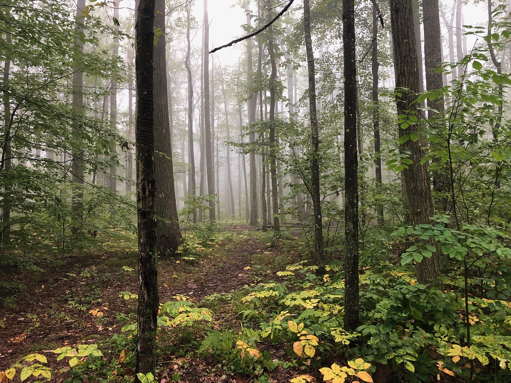
Gowango is a 3.15-mile out-and-back trail in Pennsylvania managed by the Forest Service. The trail gains 1,048 feet of elevation over its round-trip distance.
Add to a trip & share
Keep exploring — more trails worth the drive
 Photo: U.S. Army Corps of Engineers, photographer not specified or unknown, Public domain (via Wikimedia Commons)
Sams Rocks
~12 min drive
3.60-mile out-and-back trail in Pennsylvania with moderate difficulty.
Photo: U.S. Army Corps of Engineers, photographer not specified or unknown, Public domain (via Wikimedia Commons)Rimrock Overlook
~12 min drive
A 2.07-mile out-and-back Pennsylvania trail with concrete, dirt, and wooden staircase surfaces, connecting to NRSR 454.
Robert Frost Interpretive - New York
~4 min drive
A challenging 42.56-mile point-to-point backcountry trail through Pennsylvania wilderness.
Jrembt - Laurel
~12 min drive
4.66-mile out-and-back trail in Pennsylvania with 251 ft gain.
 Photo: Andy Arthur on Flickr, CC BY 2.0 (via Wikimedia Commons)
Jrembt - Seneca
~12 min drive
3.00-mile out-and-back trail in Pennsylvania with moderate difficulty.
 Photo: Ryan Hallock, CC BY 2.0 (via Flickr)
Flagg Trail
~12 min drive
1.31-mile point-to-point trail in New York with 636 ft elevation gain
Bullis Hollow
~6 min drive
An 8.39-mile moderate out-and-back trail in Pennsylvania with single-track, unimproved surfaces and connections to the North Country Trail network.
Kinzua Connector
~14 min drive
3.84-mile out-and-back trail in Pennsylvania with 364 ft elevation gain.
 Photo: Photo taken by the staff of the Chief Cornplanter Council.
Original uploader was Kjbsa at en.wikipedia, CC BY-SA 3.0 (via Wikimedia Commons)
Photo: Photo taken by the staff of the Chief Cornplanter Council.
Original uploader was Kjbsa at en.wikipedia, CC BY-SA 3.0 (via Wikimedia Commons)Jrembt - Coal Knob
~15 min drive
5.15-mile moderate out-and-back trail in Pennsylvania.
Photo: Andy Arthur on Flickr, CC BY 2.0 (via Wikimedia Commons)Jrembt - Blacksnake
~12 min drive
Easy 1.35-mile out-and-back trail in Pennsylvania.
